Projects
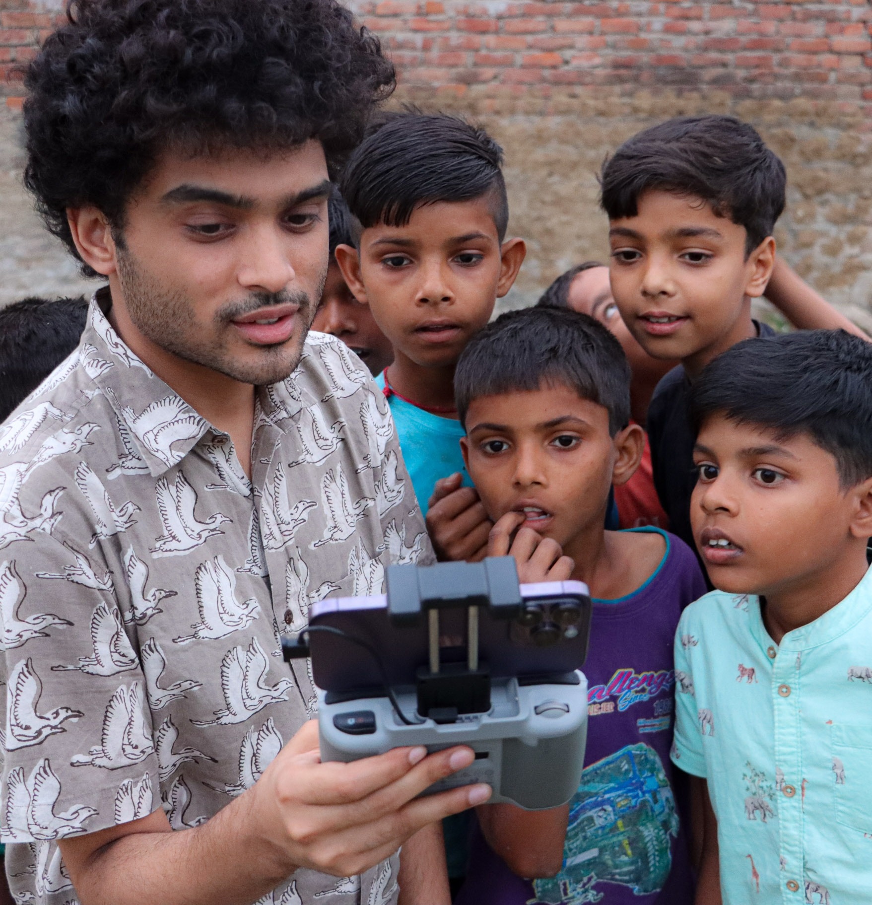
Collaborative Earth - Ganges Lab Field Work and Fundraising
For the Ganges Lab, I collected aerial data using drones, co-ordinated with government stakeholders, and led the fundraising initiatives, taking our Carbon Dioxide Removal (CDR) proposal to the final round of the Frontier Pre-Purchase Program for 2024.
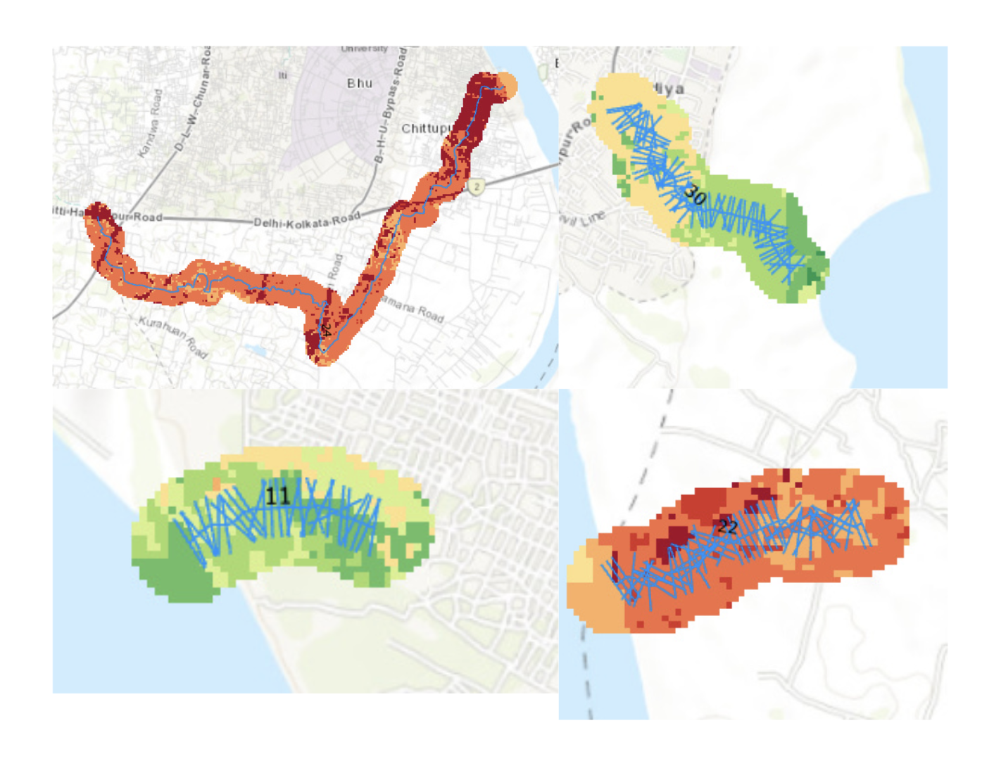
Collaborative Earth - Ganges Lab 'Naala' Taxonomy
To define an approach to quantify abstract ecological features, I devised a barcode system that quantified pixel-level vulnerability along naala transects, which were then used in clustering algorithms alongside other morphological factors such as naala length, braiding, and sinuosity. This enabled us to prioritise high-risk naalas for targeted interventions, for which we are presently planning in-situ remediation strategies.
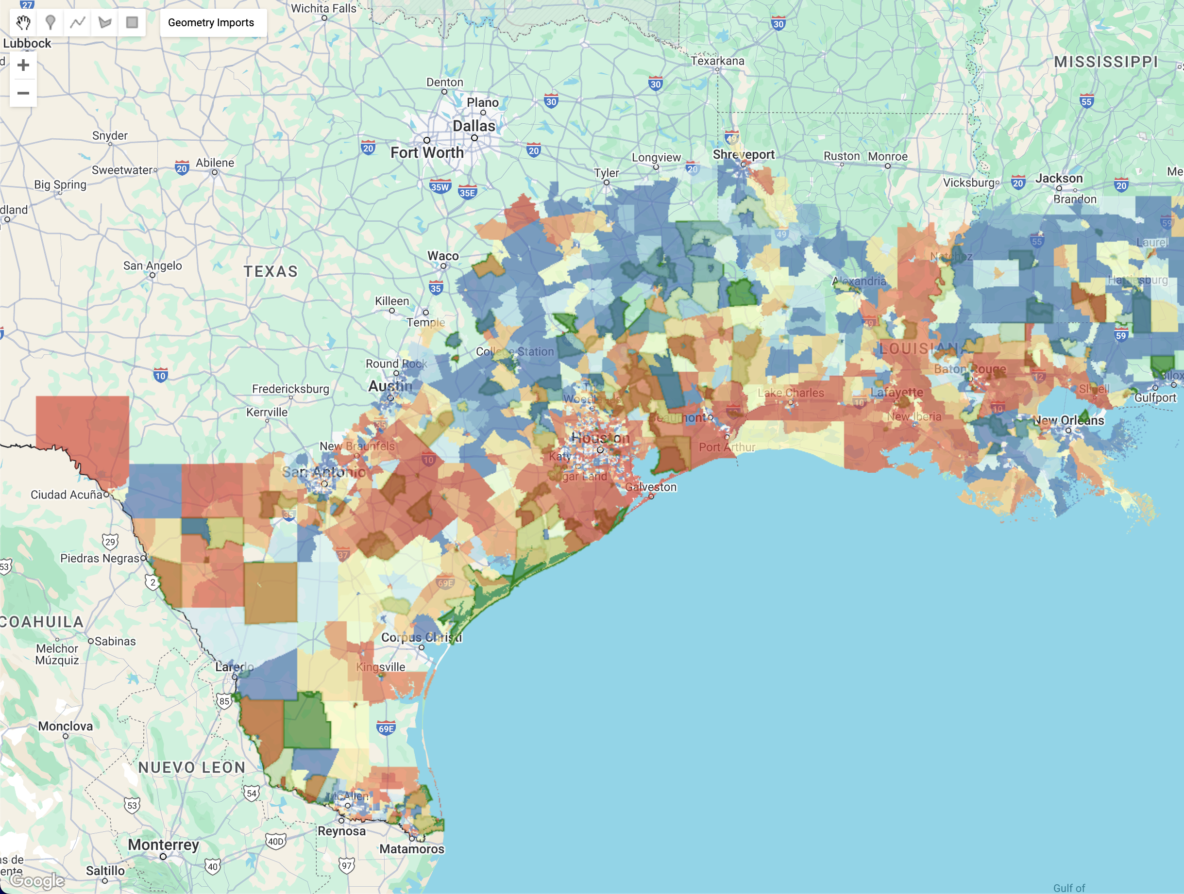
Collaborative Earth - Coastal Forested Wetlands Lab
I worked with the Coastal Forested Wetlands (CFW) Lab to create a site-suitability map using socio-economic and hydrological layers to support multi-dimensional assessment of the suitability and priority of each site for reforestation.
Wuuii - Graph Neural Network
I trained a Graph Attention Network model to represent the spread of wildfires and enable a more precise understanding of the factors that facilitate fire propagation. This will help inform preventive strategies while planning housing structures.
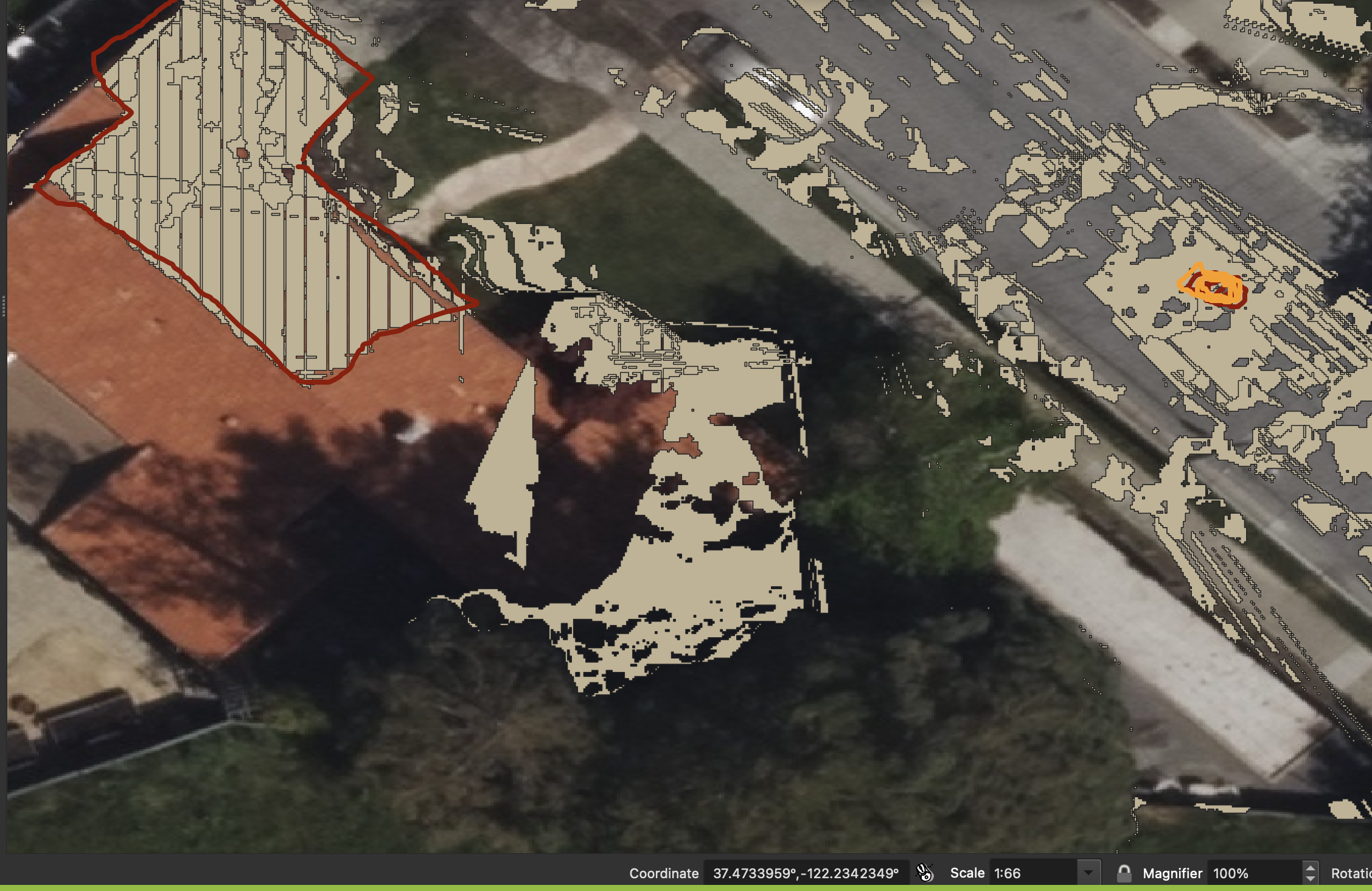
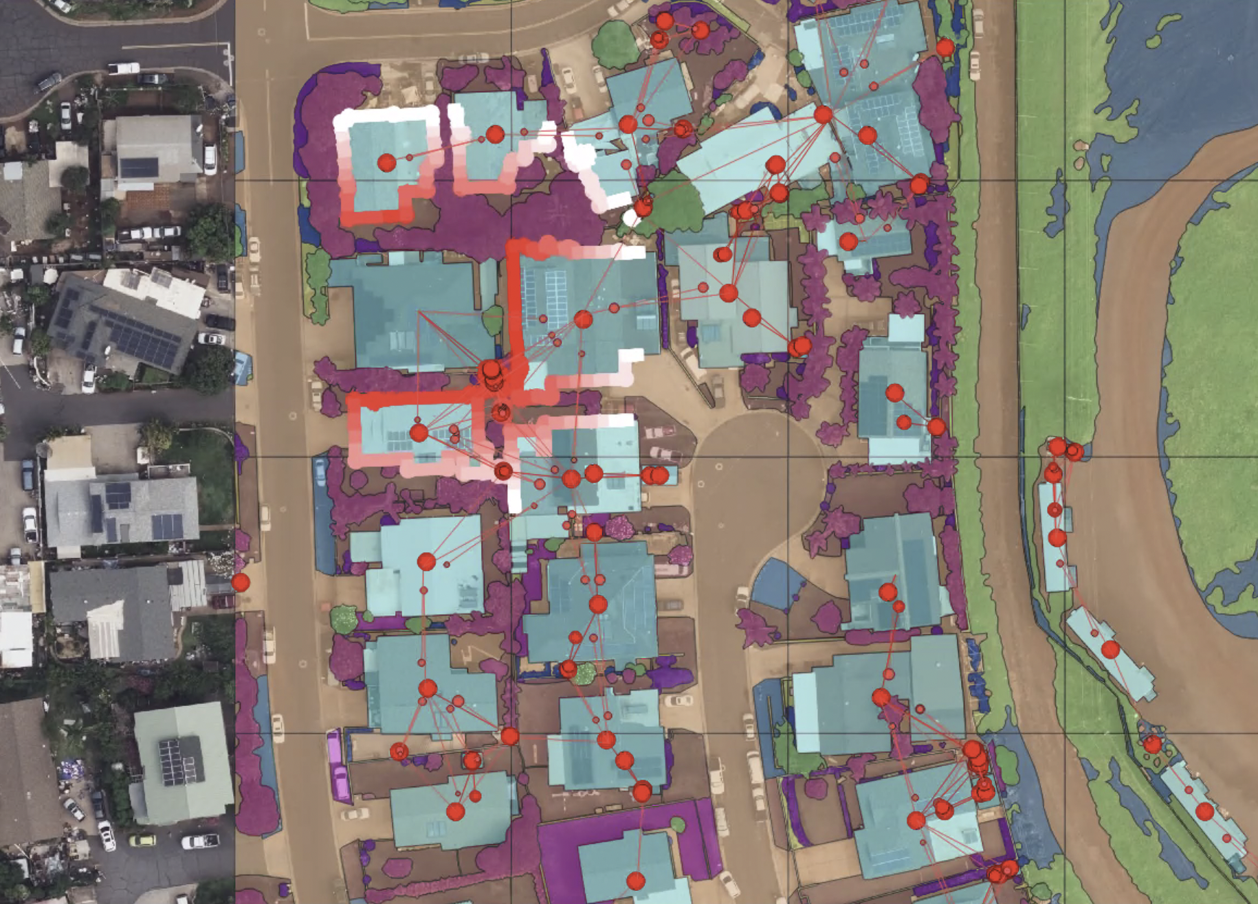
Wuuii - SAM Fine-Tuning
To enable a more comprehensive integration of both aerial and street view perspectives while assessing wildfire risk, I fine-tuned the Segment Anything Model (SAM) on street view imagery to generate segmentation masks for house features. Using these masks, I translated visible street view features onto aerial maps by adding feature polygons with depth parameters instead of simple point features.
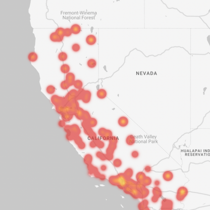
UC Berkeley - Wildfire Risk Prediction
With the aim of creating an explainable tool for wildfire risk prediction, I created a model where we could change the parameter values to see the conditions under which wildfire risk increases. We attended a controlled burn to better understand the factors influencing wildfire spread, where we also got a chance to interact with firefighters to ensure that the models were explainable, and hence accessible, for adoption by emergency services.
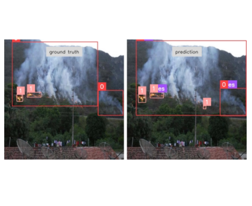
Eirene AI - Predicting Fire from CCTV Footage
During my work at Eirene AI, I fine-tuned a RT-DETR model to detect fire and smoke in real-time, which led to an increased mean average precision and led to quicker detection of fires. The model will be deployed on-edge on CCTV cameras across California.